


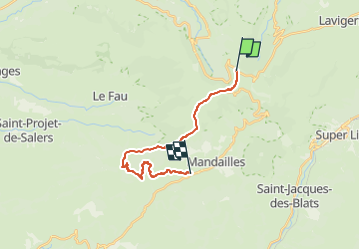
Pas de Peyrol/ Saint-Julien-de-Jordanne

geoffrayLayeux
User

Length
16.8 km

Max alt
1729 m

Uphill gradient
460 m
Km-Effort
25 km

Min alt
893 m

Downhill gradient
1144 m
Boucle
No
Creation date :
2025-02-25 12:05:05.576
Updated on :
2025-02-25 12:06:08.978
5h43
Difficulty : Very difficult

FREE GPS app for hiking
 SityTrail
IGN / Geographical institutes
SityTrail Plus
The world is yours!
About
Trail Walking of 16.8 km to be discovered at Auvergne-Rhône-Alpes, Cantal, Le Falgoux. This trail is proposed by geoffrayLayeux.
Positioning
Country:
France
Region :
Auvergne-Rhône-Alpes
Department/Province :
Cantal
Municipality :
Le Falgoux
Location:
Unknown
Start:(Dec)
Start:(UTM)
474151 ; 4995712 (31T) N.
Comments